Antelope Canyon Map: Entrances, Distances and What Is at Each Pin
Everything sits within a short drive of Page: two canyon entrances east on Highway 98, the Canyon X office farther out, the marina on Lake Powell and Horseshoe Bend to the south. The antelope canyon map below shows the distances, and this page explains what happens at each pin.
Updated 15 October 2026
In shortAntelope Canyon sits just east of Page, Arizona, inside Lake Powell Navajo Tribal Park. Pin the Upper entrance at the three-mile mark east of town on Highway 98, drop the Lower pin on Indian Route 222 under 10 minutes out, and put the Antelope Canyon X check-in pin at Milepost 308. Antelope Point Marina is 9 road miles from Page, and Horseshoe Bend lies south on US Highway 89.
3 milesUpper entrance east of Page
Milepost 308Antelope Canyon X check-in
9 road milesPage to Antelope Point
120 ft (37 m)Canyon depth
Main sightViewpoint or second slot canyonTown and base for toursVisitor point or practical stop
The canyon entrances lie just east of Page off Highway 98, with Horseshoe Bend to the south and Lake Powell to the north.
Where is Antelope Canyon, and what the map shows
Antelope Canyon lies on the Navajo Nation immediately east of Page, Arizona, inside Lake Powell Navajo Tribal Park. Highway 98 is the spine of the area: head east out of town and the Upper Antelope entrance and the turn for the Lower site come first, within a few miles, with the Antelope Canyon X office farther out. The canyon floor sits at 3,704 feet (1,129 m) with walls standing about 120 feet (37 m) above it, which is why you can drive past all of it and see nothing from the road.
The antelope canyon map on this page carries six pins: the Upper Antelope park entrance on Highway 98, the Lower Antelope site on Indian Route 222, the Antelope Canyon X check-in at its highway milepost, Antelope Point Marina where the water route starts, Horseshoe Bend south of town on US Highway 89, and the Lake Powell Navajo Tribal Park office on North Navajo Drive in Page. Page is the hinge for all of it: the marina, the farthest of the canyon-area pins, is 9 road miles and about 15 minutes out.
Distances are the easy part of planning here. Every location on this map can only be entered on a guided tour booked with a licensed operator, a Navajo guide is compulsory, and there is no self-guided or walk-in-on-your-own access anywhere in the canyon. Tribal park entry is charged at $15 per person for each entry, separately from the tour price, and because the canyon falls outside Glen Canyon National Recreation Area, America the Beautiful and Glen Canyon passes buy you nothing at the gate.
Two pins covered without a car
If you are not driving yourself, this one long day picks you up from select hotels and covers Lower Antelope and Horseshoe Bend with the Navajo Nation Permit Fee, both admissions and a deli lunch included, from $160 over 14 to 15 hours, 4.9 ★ (8468 reviews).
Three separate check-in points serve three separate canyons, and arriving at the wrong one costs you the tour. The Upper Antelope park entrance is about three miles east of Page on Highway 98, and that is where 4x4 tour trucks collect groups for the ride to the slot, roughly 15 minutes each way. The Lower Antelope site is reached from Indian Route 222, less than 10 minutes' drive east of Page off Highway 98, parking there is free and there is no vehicle transfer: you walk in from check-in.
Antelope Canyon X check-in sits at Milepost 308 on Highway AZ-98, farther east than both Antelope entrances, and no pick-up service runs to it from town. The water approach heads the other way off Highway 98, down Marina Parkway to Antelope Point Marina at 537 Marina Parkway, 9 road miles and about 15 minutes from Page.
Set your watch to Arizona time before you drive out to any of these pins. Departures are timed to Mountain Standard Time all year, with no daylight saving; the Navajo Nation around these pins does switch, and a handset that latches onto that zone will show a time an hour away from the one printed on your booking.
Pin on the map
Where it is
From Page
Upper Antelope entrance
Highway 98; 4x4 tour vehicles collect visitors here
About 3 miles east, then roughly 15 minutes by truck each way
Lower Antelope site
Indian Route 222, off Highway 98, free parking
Less than 10 minutes' drive east
Antelope Canyon X check-in
Milepost 308 on Highway AZ-98, check-in on site
Farther east than the Upper and Lower entrances
Antelope Point Marina
537 Marina Parkway, via Marina Parkway off Highway 98
9 road miles, about 15 minutes
Wahweap, Lake Powell
North-west of town on the lake
8 road miles, about 14 minutes
Horseshoe Bend trailhead
US Highway 89 between mile markers 545 and 544
About 5 miles south of the Carl Hayden Visitor Center
Lake Powell Navajo Tribal Park office
337 N. Navajo Drive, Page
In town
How the walk works inside each section
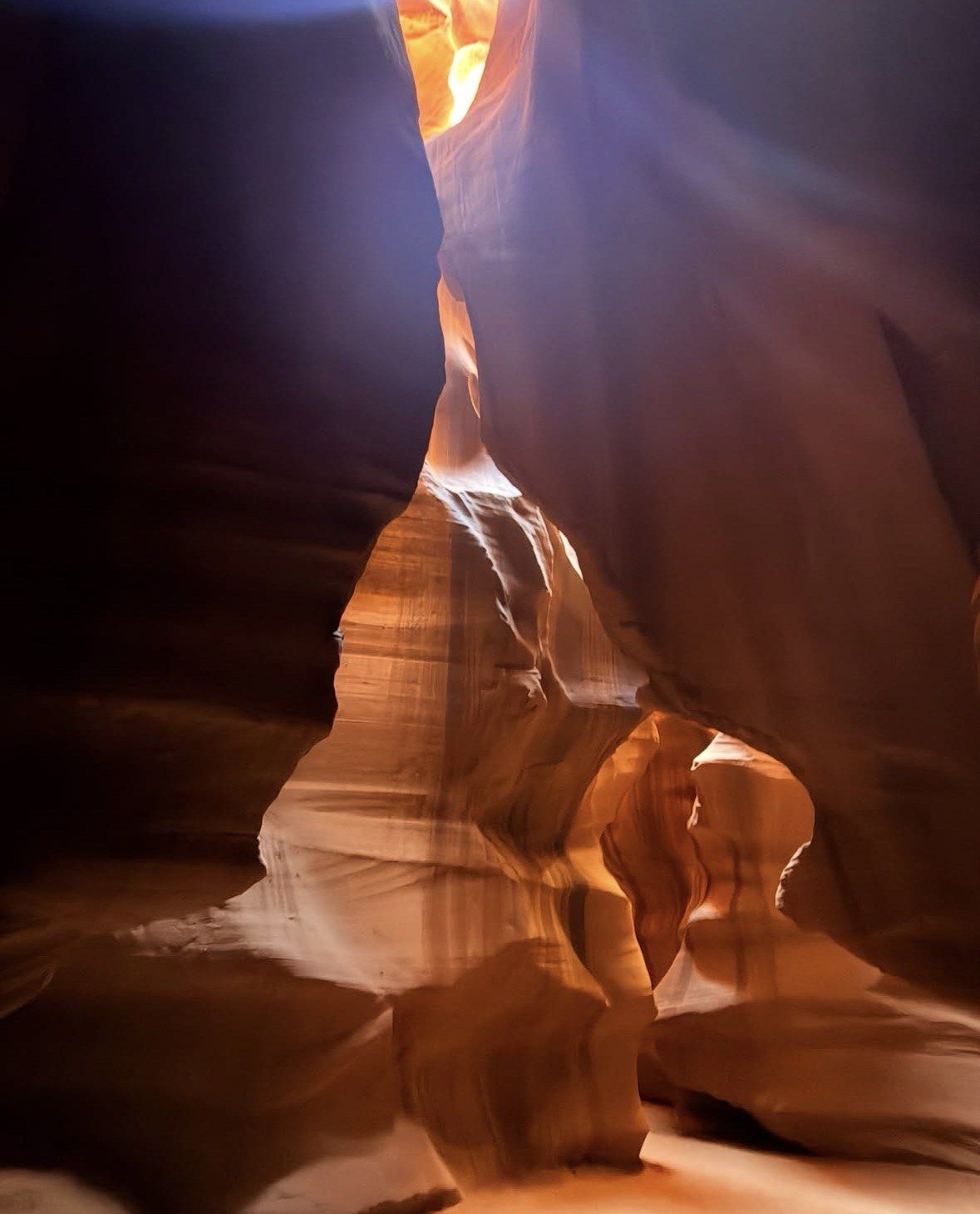
Upper Antelope, Tse'bighanilini on the park's own signs, is the short one: about 660 feet (200 m) of walkable corridor, now covered in a single direction so groups move forward instead of squeezing past each other. The floor is sand and the walking inside involves no ladders or stairs. The effort is saved for the end, where 150 steps take you back up to the trucks. Reckon on about an hour in the slot, with a park ceiling of two hours on time inside that has been in force since 1 May 2011.
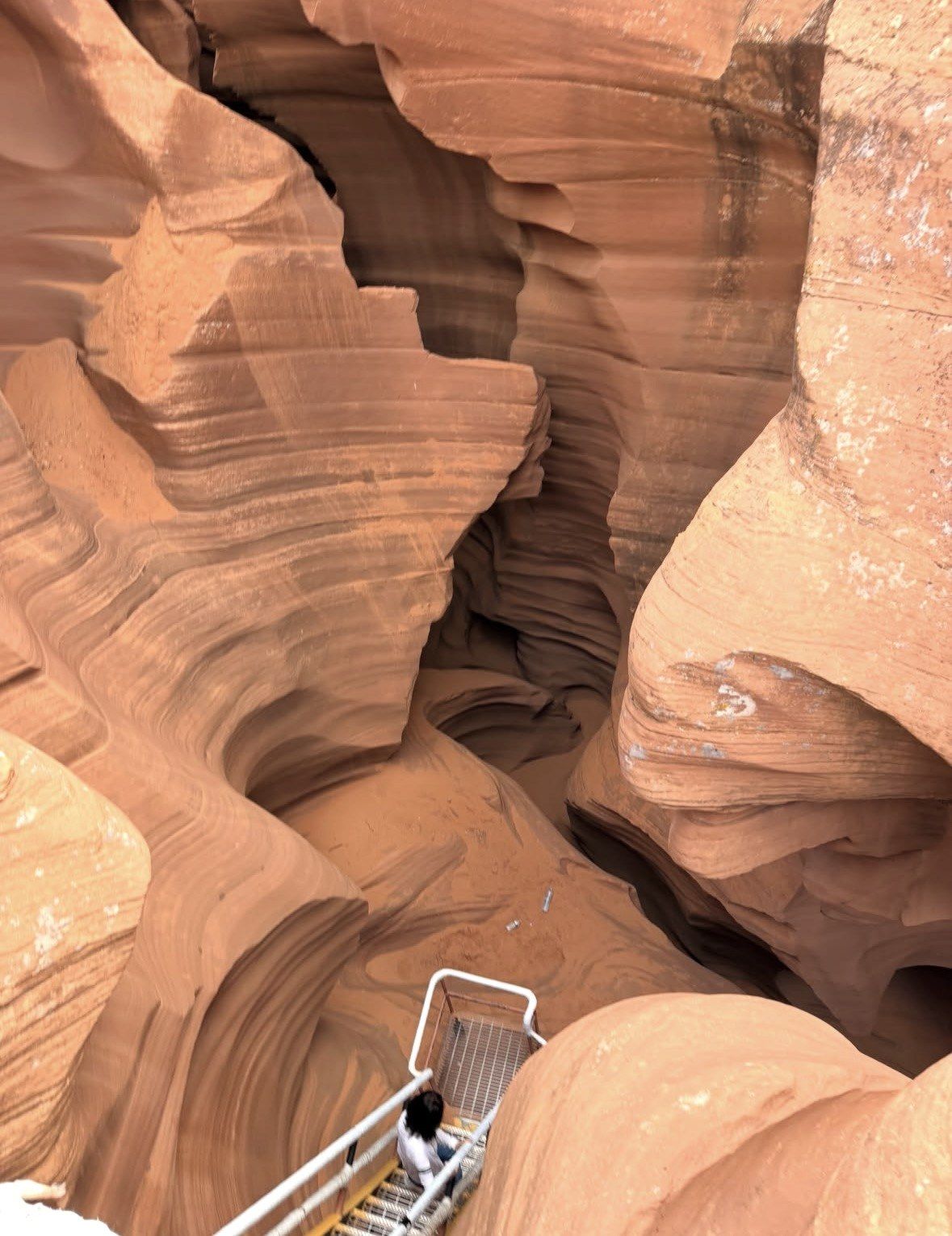
Lower Antelope, Hasdez'twazi', works the opposite way round because you descend into it. Five flights of stairs drop into the largest cavern on the route, and the ladder sections carry handrails bolted into the sandstone. The passage runs about 1,335 feet (407 m) and the hike comes to roughly 1.1 miles round trip over 60 to 90 minutes. The park's own caution for this pin covers narrow passages and steep stairs, which it says may not suit visitors who are claustrophobic.
Antelope Canyon X covers two separate slot passages on one guided walk and never enters Upper or Lower Antelope. Entry and exit use one staircase about 200 feet long built from railroad ties, with no ropes or ladders on the route, and the ground between them is sand. The standard hike runs about an hour and a half, with check-in 30 minutes before the booked time.
Upper Antelope: level sand inside, then 150 steps back up to the vehicles
Lower Antelope: five flights of stairs down, plus ladders with handrails fixed into the walls
Antelope Canyon X: one railroad-tie staircase of about 200 feet, in and out the same way
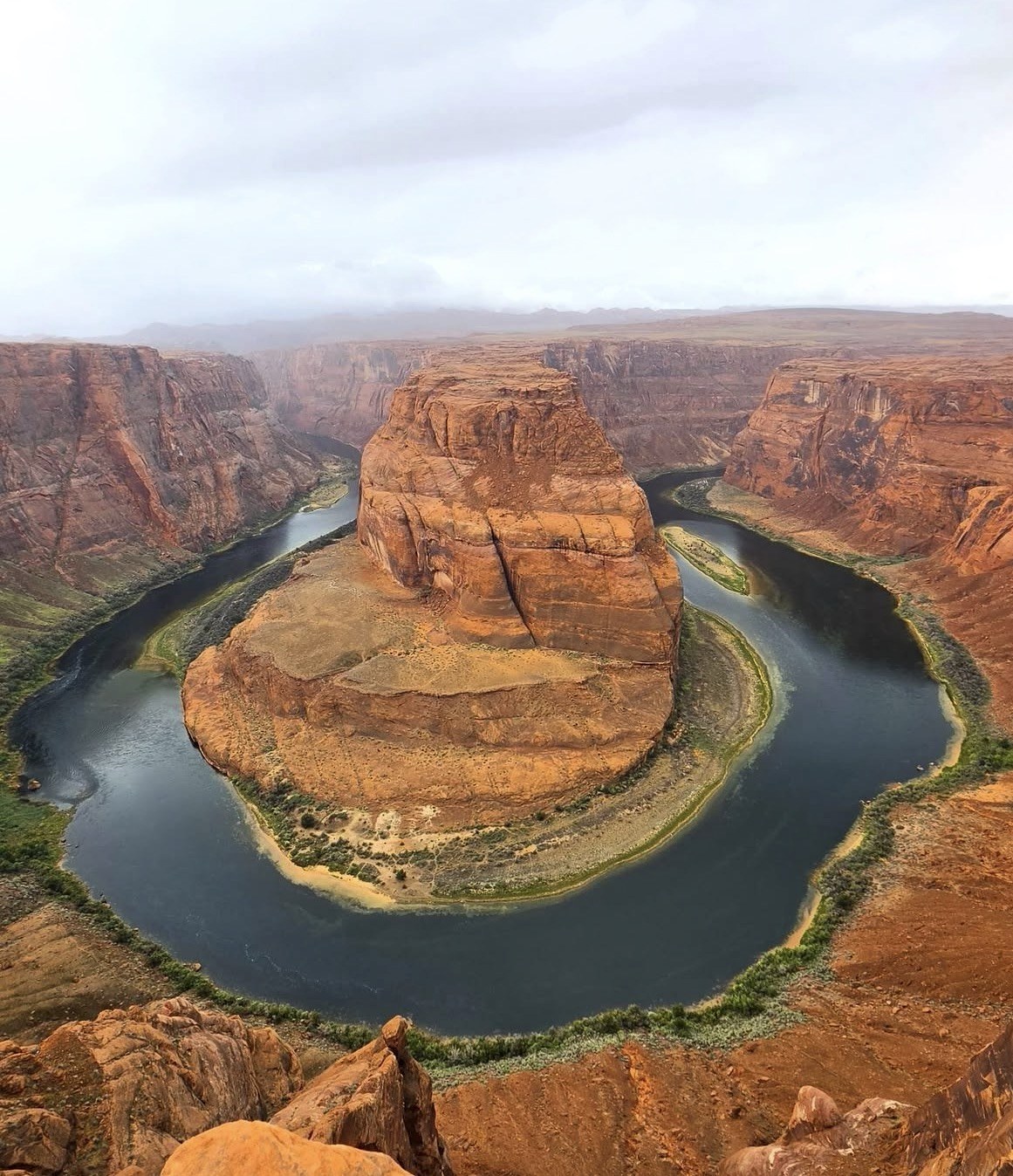
Horseshoe Bend: a hardened, ADA-accessible path, 1.5 miles (2.4 km) round trip, with the river about 1,000 feet below the overlook
Antelope Point and the water approach on Lake Powell
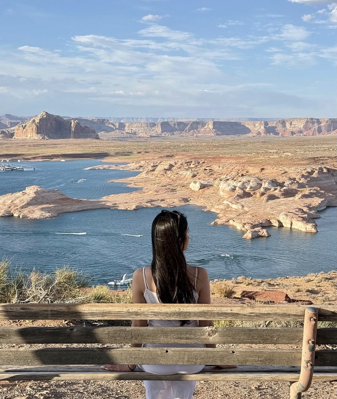
The water version of Antelope Canyon is the flooded arm at the canyon's mouth, and it starts at Antelope Point, 9 road miles and about 15 minutes from Page. The Park Service names Antelope Point as the key access point for kayakers heading into Antelope Canyon, because Wahweap, 8 road miles and roughly 14 minutes from town on the other side, sits 7.3 river miles away and is too far to serve paddlers.
Lake level matters more than road distance on this part of the map. Lake Powell stood at 3,519.10 feet on 13 October 2026 against a full pool of 3,700 feet, and at those levels the Antelope Point public launch ramp is open for paddlecraft launching only. Everything afloat inside Antelope Canyon travels at no-wake speed, since the canyon is a designated wakeless zone, each passenger needs a flotation device of the right size, and anyone aged 12 or under wears a Coast Guard-approved lifejacket while the boat is moving.
Horseshoe Bend and the pins inside Page
Horseshoe Bend is the one headline stop that is not east of town. Look for the car park on US Highway 89, between mile markers 545 and 544, roughly 5 miles south of the Carl Hayden Visitor Center; from there the path to the viewpoint is hardened and ADA-accessible, 1.5 miles (2.4 km) there and back, with the Colorado River some 1,000 feet below the rim. Parking is charged by the City of Page and National Park Service passes, America the Beautiful included, are not valid for it; on holidays and busy weekends the city can move everyone onto a shuttle once the car park fills.
Two pins sit inside town itself. The administrative pin for the tribal park is 337 N. Navajo Drive, with the telephone number (928) 645-0268 if you need to check a date before travelling. Its official page gives summer hours of 8:00 a.m. to 5:00 p.m. and lists four closed days: Thanksgiving Day, Navajo Nation Family Day the following day, Christmas Day and New Year's Day. Nothing is published for the winter months, so confirm your date rather than assume. The airport pin is 238 10th Avenue, within the street grid of Page, where Contour Airlines flies to Phoenix daily and rental cars are available on site.
Seeing it in one day, and in what order
Both Antelope sections fit comfortably into one day, and the order that works is Lower early, Upper at midday. Each visit takes roughly one and a half to two hours once check-in is counted, and the two sites are only a few minutes apart by road east of Page. Take the earliest Lower slot you can get: it is the coolest and quietest part of the day and it leaves the middle hours free.
Midday is when Upper Antelope earns its higher price, because the light beams need the sun close to overhead and a clear sky. The published window is April through September, and of the Upper departures an authorised operator publishes, the 11:20 a.m. slot is the one it singles out for the strongest odds of a beam. Outside those months the beams simply are not there, so take an early Upper slot and spend midday somewhere else.
Keep the receipt from your first tribal park entry and show it at the second canyon; the City of Page tourism office says that stops the $15 entry fee being charged a second time. Close the day south of town at Horseshoe Bend, or swap one Antelope section for Antelope Canyon X at Milepost 308 if your dates are already full. From July through September hold a spare half-day: Navajo Nation Parks warns that bad weather can shut the canyons at short notice, and the National Weather Service dates the Arizona monsoon from 15 June to 30 September.
Questions people ask
Can I drive to the entrance and walk into Antelope Canyon on my own?
No. Not one of the canyon pins on this map works that way: a Navajo guide is required at all of them, and the whole Lake Powell to Antelope Canyon park area opens only to groups on a tour booked through a licensed operator. Park entry costs $15 per person for each entry and is charged separately from the tour price. Navajo Nation Parks also prohibits littering, rock climbing, drones and dogs across all its park lands.
Which Antelope Canyon entrance is closest to Page?
Lower Antelope wins on driving time: its site sits off Highway 98 on Indian Route 222, under 10 minutes east of town, and parking there costs nothing. The Upper entrance is about three miles east on Highway 98, but from there you still have a 4x4 transfer of roughly 15 minutes each way. Antelope Canyon X check-in lies farther east again, at Milepost 308 on Highway AZ-98.
Do national park passes work anywhere on this map?
They are no use at the canyon pins: Antelope Canyon lies outside Glen Canyon National Recreation Area, and neither the America the Beautiful pass nor a Glen Canyon pass is accepted for entry. They are also not valid for the Horseshoe Bend car park, which the City of Page charges for. Glen Canyon National Recreation Area itself is open 24 hours a day year-round, and the Carl Hayden Visitor Center opens daily except Thanksgiving, Christmas and New Year's Day.
How far are the Lake Powell access points from Page?
Antelope Point, the marina nearest Antelope Canyon, is at 537 Marina Parkway, 9 road miles and about 15 minutes from town via Marina Parkway off Highway 98. Wahweap is 8 road miles and about 14 minutes away on the other side of Page. Lees Ferry, downstream below Glen Canyon Dam, is 43 road miles and roughly 50 minutes out.
Does the map help me plan for light beams?
Mainly by telling you which canyon to aim for. Beams form in Upper Antelope from April through September on clear, sunny days, and in Antelope Canyon X from May through early August, where the popular visiting window runs between 10:30 a.m. and 1:00 p.m. All tour times follow Arizona time with no daylight saving, so the beam hours do not shift in summer. Early April and late October beams are smaller and shorter-lived.
Already in Page and only half a day free: Lower Antelope Canyon and Horseshoe Bend in one guided run of 3 hours 35 minutes, from $269, 4.8 ★ (192 reviews), in an air-conditioned vehicle with bottled water and snacks and no restroom on board. Cancel it at least 24 hours ahead of the departure time and the whole amount comes back to you.